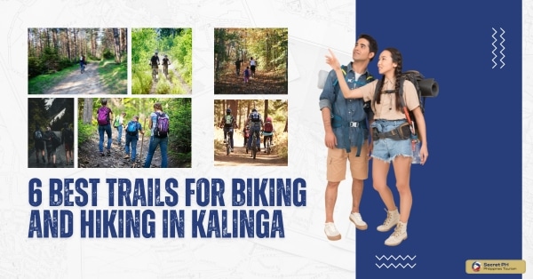
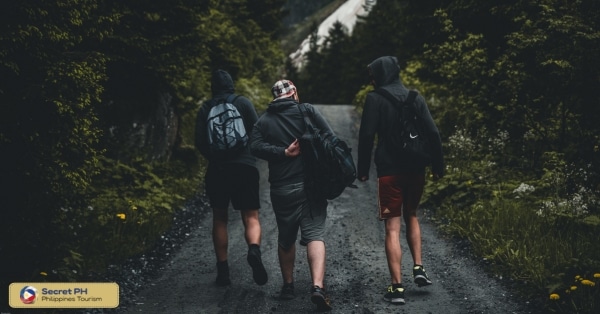
Kalinga is a province in the Philippines known for its lush mountains and beautiful views. It’s the perfect place to go biking and hiking with plenty of trails that lead to breathtaking vistas.
Discover the wonders of Kalinga through its best biking and hiking trails. From the lush forests and scenic viewpoints of Mount Sinalitan to the challenging trek to Buscalan Tinglayan, home to the legendary Whang-Od, Kalinga offers diverse experiences. Mount Tangob’s panoramic vistas, Mount Maybinulong’s serene landscapes, and the epic Cordillera Great Traverse Trail provide something for every adventure seeker.
Whether you’re looking for an easy day hike or an extended mountain trek, Kalinga has something to offer everyone. We’ve rounded up some of the best trails to explore in Kalinga, so grab your hiking boots and enjoy the journey!
1. Mount Sinalitan
Mount Sinalitan is a beautiful mountain located in the municipality of Tinglayan, Kalinga. It is a popular destination for hikers and mountain climbers due to its easy-to-moderate difficulty level and stunning views. The mountain is also home to a variety of flora and fauna, making it a great place to experience the natural beauty of the region.
The hike to Mount Sinalitan begins at the Tinglayan Municipal Hall. From there, hikers will follow a well-marked trail through the forest. The trail is mostly gradual, but there are a few steep sections. The hike takes about 2-3 hours to complete, depending on the hiker’s pace.
Once at the summit, hikers will be rewarded with stunning views of the surrounding countryside. On a clear day, hikers can see for miles in every direction. The summit is also a great place to watch the sunrise and sunset.
Mount Sinalitan is a great place to experience the natural beauty of Kalinga. It is an easy-to-moderate hike with stunning views and a variety of flora and fauna. If you are looking for a challenging hike, Mount Sinalitan is a great option.
For directions, click here.
2. Buscalan Tinglayan
Buscalan is a remote village in the municipality of Tinglayan, Kalinga. It is known as the home of the last traditional hand-tap tattoo artist, Apo Whang-Od. She is a living legend and a National Living Treasure of the Philippines.
The village is located in the mountains of Kalinga and is surrounded by lush forests and rice terraces. The people of Buscalan are the Butbut tribe, who have a rich culture and heritage. The Butbut people are known for their traditional tattoos, which are considered to be a symbol of beauty and strength.
In addition to its traditional tattoos, Buscalan is also known for its beautiful scenery and its friendly people. The village is a popular tourist destination, and many visitors come to meet Apo Whang-Od and learn about the Butbut culture.
If you are planning a trip to Buscalan, there are a few things you should keep in mind. First, the village is quite remote, so it is important to plan your trip carefully. There are a few guesthouses in the village, but it is advisable to book your accommodation in advance.
Second, the people of Buscalan are very welcoming and hospitable. However, it is important to respect their culture and customs. Be sure to dress modestly and ask permission before taking any photographs.
Finally, if you are planning to get a tattoo from Apo Whang-Od, be sure to bring cash and be prepared for a long wait. She is very popular, and there is often a long line of people waiting to get tattooed.
A trip to Buscalan is a unique and unforgettable experience. It is a chance to learn about a rich culture and heritage and to meet some of the most friendly people in the Philippines.
For directions, click here.
3. Mount Tangob
Mount Tangob, is nestled in the breathtaking landscapes of Kalinga. This moderate to difficult trail spans approximately 9 kilometers and is renowned for its lush forests, picturesque streams, and awe-inspiring panoramic vistas of the Cordillera Mountains.
The hike to Mount Tangob begins at the Tanudan Municipal Hall. From there, hikers will follow a well-marked trail through the forest. The trail is mostly gradual, but there are a few steep sections. The hike takes about 2-3 hours to complete, depending on the hiker’s pace.
The summit rewards trekkers with sweeping views of the surrounding valleys and peaks, making the journey well worth the effort. Mount Tangob is a must-visit destination for those seeking both natural beauty and a memorable hiking adventure in the heart of Kalinga.
Other things to consider:
- Mount Tangob is a sacred mountain for the indigenous people of the region. It is important to be respectful of their culture and customs.
- The mountain is home to a number of endangered species. Be careful not to disturb the wildlife.
- The weather on Mount Tangob can be unpredictable. It is important to be prepared for all types of weather conditions.
- Mount Tangob is a beautiful mountain with a lot to offer hikers and mountain climbers. It is a great place to experience the natural beauty of Kalinga and to learn about the region’s unique culture.
For directions, click here.
4. Mount Maybinulong
Mount Maybinulong is a beautiful mountain located in the municipalities of Rizal and Pinukpuk, Kalinga. This moderately challenging trail spans approximately 7 kilometers and is known for its stunning landscapes and serene ambiance. As you traverse the path, you’ll find yourself surrounded by lush greenery and possibly even catch glimpses of local wildlife.
The hike to Mount Maybinulong begins at the Katabbogan Trailhead in Rizal. From there, hikers will follow a well-marked trail through the forest. The trail is mostly steep and challenging, and there are a few sections where hikers will need to use their hands and feet to climb. The hike takes about 8-10 hours to complete, depending on the hiker’s pace.
Mount Maybinulong is a haven for birdwatchers, making it an ideal spot for nature enthusiasts. The tranquil atmosphere and captivating scenery make this mountain a perfect destination for those seeking a peaceful yet rewarding hiking adventure in Kalinga’s pristine wilderness.
Other things to consider:
- Mount Maybinulong is a challenging hike. It is important to be in good physical condition before attempting to hike to the summit.
- The weather on Mount Maybinulong can be unpredictable. It is important to be prepared for all types of weather conditions.
- It is advisable to hire a local guide to help you hike to Mount Maybinulong. The guides can help you navigate the trail and ensure that you have a safe and enjoyable hike.
- Mount Maybinulong is a challenging but rewarding hike. It is a great place to experience the natural beauty of Kalinga and to test your physical and mental limits.
For directions, click here.
5. Mount Maybinulong Via Katabbogan
Mount Maybinulong via Katabbogan is a challenging but rewarding hike in the Cordillera Mountains. The trail begins at the Katabbogan Trailhead in Rizal, Kalinga and ascends through dense forests, rice terraces, and mountain meadows. The hike takes approximately 8-10 hours to complete and is best attempted early in the morning to avoid the heat of the day.
The trail is well-marked, but there are a few sections where hikers will need to use their hands and feet to climb. There are also a few river crossings, so it is important to wear waterproof shoes. Hikers should also be prepared for all types of weather conditions, as the weather on Mount Maybinulong can be unpredictable.
For those seeking a thrilling and less-crowded hiking experience, Mount Maybinulong Via Katabbogan is a trail that offers both a physical challenge and the chance to explore the untamed beauty of Kalinga’s wilderness.
For directions, click here.
6. Cordillera Great Traverse Trail
The Cordillera Great Traverse Trail (CGTT) is an ambitious hiking trail that traverses the six provinces of the Cordillera Administrative Region (CAR) in the Philippines. The trail is approximately 444 kilometers long and takes approximately 17-20 days to complete. The CGTT is a challenging hike, but it is also an incredibly rewarding experience.
The CGTT passes through a variety of landscapes, including forests, mountains, rice terraces, and villages. Hikers will have the opportunity to experience the rich culture and heritage of the Cordillera people. The trail also offers stunning views of the Cordillera Mountains.
The CGTT is not for the faint of heart. It is a challenging hike that requires a good level of fitness and experience. Hikers should be prepared for all types of weather conditions and should be able to navigate the trail independently.
If you are considering hiking the CGTT, there are a few things you need to know:
- The best time to hike the CGTT is during the dry season, which runs from November to April.
- You will need to obtain a permit from the Department of Environment and Natural Resources (DENR) before starting your hike.
- It is advisable to hire a local guide to help you hike the CGTT. The guides can help you navigate the trail and ensure that you have a safe and enjoyable hike.
The Cordillera Great Traverse Trail is a challenging but rewarding hike for experienced hikers. It is a great way to experience the natural beauty of the Cordillera Mountains and to learn about the region’s unique culture.
In conclusion
The Kalinga province in the Philippines is a stunning landscape of lush forests, spectacular mountain ranges, and picturesque villages. Whether you’re looking for an easy day hike or an extended mountain trek, Kalinga has something to offer everyone.
From the iconic Mount Sinalitan to the legendary Buscalan Tinglayan, home of Apo Whang-Od, to the challenging Cordillera Great Traverse Trail, Kalinga offers a variety of experiences for hikers and mountain climbers. With its stunning views and rich cultural heritage, Kalinga is an ideal destination for any adventure seeker.